
Finding Burnsville Street Records
Begin a Burnsville street search with the delivery address as written, including its direction, street type, and unit. First confirm the postal form, then use the address or Parcel ID in Dakota County Property Information. Save the selected parcel, its municipality, legal description, and whether the map identifies Abstract or Torrens land. Those fields remain useful when a Burnsville street label changes or a Burnsville parcel is divided. The owner mailing field is for tax correspondence. It may differ from the Burnsville parcel location and does not establish that the owner lives there.
- Use the USPS address lookup to standardize the Burnsville address and retain the returned street and unit form.
- Search Dakota County Property Information by address or PID, then record the parcel’s legal description and municipality.
- Open map layers and adjoining parcels only to understand the street’s physical and legal context, not to infer a household.
- Use the legal description and recorded party names in RecordEASE to inspect dated instruments.
- For an older Burnsville address, compare the deed trail with telephone books, census entries, or newspapers. The historical collections are described in the Burnsville city directory.
Registration records need more care. MNVotes confirms registration status from a name, birth information, and address. It is not a street-browsing Burnsville resident roll, and a result is not proof of occupancy at a Burnsville address. Keep the search date because the state says its data update nightly.
Burnsville Street Address Checks
Burnsville has overlapping geographies. A Burnsville city boundary, USPS delivery ZIP, Burnsville neighborhood boundary, school district, watershed district, and parcel line are different shapes. The state county and ZIP list identifies 55306 and 55337 for Burnsville, while a Census ZCTA can include other statistical geography. For one Burnsville street address, use the USPS ZIP Code Lookup instead of assigning a ZIP from a broad map.
Try a directional prefix or suffix, the full unit, and a street-type abbreviation before deciding a search failed. Dakota County allows a PID with or without dashes, and the property search can use a full address or a portion beginning with the house number and street. Write down both the typed version and the selected suggestion. That small habit prevents a later Burnsville street directory search from confusing two similar roads or losing an apartment number.
Note: A recognized postal city name or ZIP result standardizes mail delivery, but it does not identify a current person or establish a municipal boundary.
Burnsville Parcel Cards by Address
The Dakota County Property Information help page describes the panel opened by clicking a parcel. It shows owner and owner-address fields separately from the Burnsville site location, plus municipality, tax description, school district, and watershed district. Tax Info offers prior and current tax data, special assessments, and homestead status. The Building tab can show year built, bedroom and bathroom counts, and square footage. These are county assessment fields, not an independent inspection or a statement about who occupies a Burnsville address.
| Field | Use in a Burnsville street search |
|---|---|
| Address | Enter a full address or a house-number-and-street portion, then select the correct suggestion. |
| Parcel ID | Use the PID with or without dashes when an address has changed or is ambiguous. |
| Parcel panel | Read municipality, legal or tax description, owner fields, and district information. |
| Tax and Building tabs | Review assessment, special-assessment, homestead, and building fields as dated county data. |
| PDF and map links | Save printable details, plat links, and active map layer names with the access date. |
The official property help screen shows the tabs and search guidance used in this Burnsville street directory workflow.
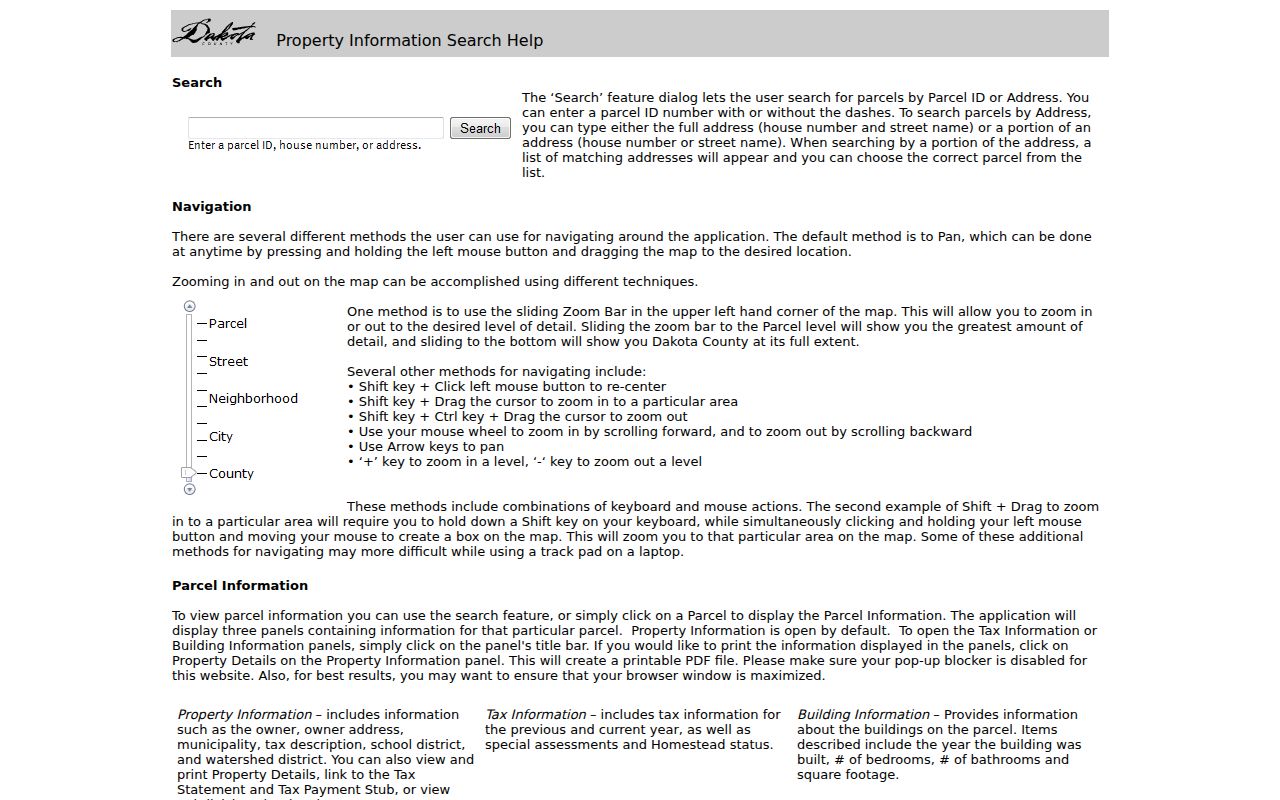
Those fields help distinguish a Burnsville parcel’s situs address from the separate owner mailing address before any Burnsville deed or historical-source search begins.
- Parcel
- A defined unit of land in the county system, usually connected to a PID and map polygon.
- Situs address
- The physical location attached to the parcel map. It is different from an owner’s mailing address.
- Plat
- A recorded map that divides land into lots, blocks, roads, or easements and can explain a changed parcel shape.
- Legal description
- The land description used in recorded documents. It is often the steadier key when an old street label is unclear.
Burnsville GIS Along a Street
Dakota County’s online property maps lead to the interactive GIS, which the county says has roughly 150 layers. Parcels, contours, aerials, roads, parks, trails, floodplains, construction, and recent-sales or Torrens layers can put a Burnsville street record in context. Click the target parcel first, then inspect adjoining polygons and active layer names. A parcel that appears close on an aerial can be separated by a right-of-way, water feature, or municipal line.
The official map entry is a useful visual check before comparing legal descriptions or plats in a Burnsville street directory search.
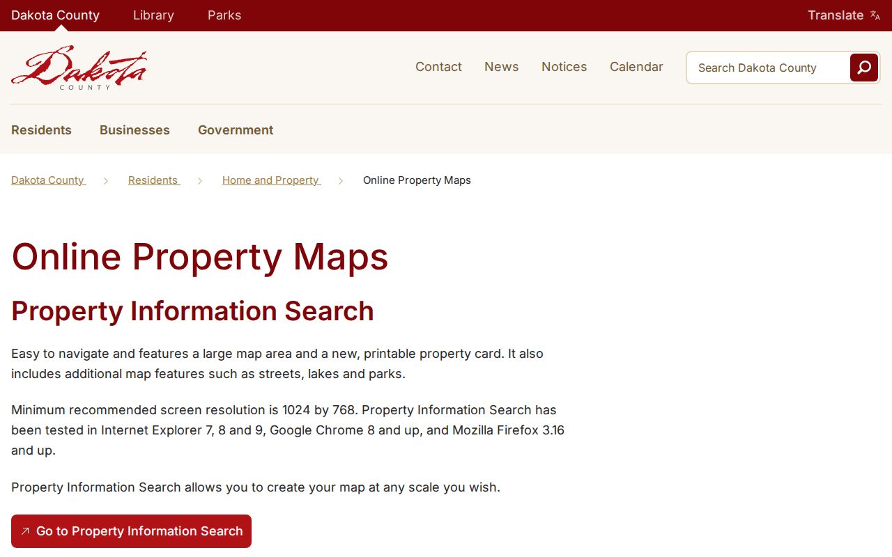
Burnsville map adjacency helps explain geography, but it does not prove common ownership, common mailing information, or a shared Burnsville household.
Burnsville’s Minnesota River bluff, Highway 13, Highway 77, County Road 5, and Civic Center Parkway can explain why nearby addresses fall in different physical or administrative areas. Use those landmarks as orientation only. The city’s neighborhood boundaries describe community context, not the people who live on a particular street.
Burnsville Permit Records by Address
City permit material adds a dated project layer to a Burnsville street search. The Burnsville permits and licenses page routes users to the ViewPoint portal and says its Search function can be used for Burnsville permit history; Building Inspections or public-data staff are the fallback. The city’s residential permit form has fields for site address, owner, contractor categories, project type, valuation, description, and a city permit number. Each label records a role in a Burnsville application. None proves who performed work or lived at the site.
Monthly commercial permit reports are posted for 2024 through 2026. Search the address string and its variants, then note the report month, permit number, project description, and whether the report is only a summary. For older reports, request the exact missing months from the city rather than asking for all records about a street. This preserves a useful Burnsville address trail without turning an applicant into an occupant.
Burnsville Street Record Coverage
Different address-keyed systems answer different questions. A good Burnsville street directory keeps the record type, date, and role visible rather than blending them into a single claim. For each Burnsville address, retain the Burnsville source date, Burnsville PID, and Burnsville record label. The county public-data route remains available when a Burnsville portal lacks the needed date range, image, or report. Inspection is free under the county request guidance; copies may have charges.
| Address record | Burnsville keeper or route | What it can show | Access channel |
|---|---|---|---|
| Burnsville property card and PID | Dakota County Property Information | Parcel, legal description, owner and mailing fields, tax and building data | Free address/PID search, GIS public terminal |
| Burnsville map and plat context | Dakota County GIS | Parcel polygons, layers, road geometry, plats where linked | Online map, Western Service Center public terminals |
| Burnsville recorded instruments | Property Taxation & Records and RecordEASE | Deeds, mortgages, liens, party roles, recording dates, legal descriptions | Login portal, county office, paid image or copy options |
| Burnsville permit activity | Burnsville Building Inspections and public-data staff | Dated applications, project categories, responsible-party labels | ViewPoint search, monthly reports, request for older material |
| Burnsville registration status | Minnesota Secretary of State | Status for an individual search with required personal inputs | MNVotes lookup, controlled voter-information request |
| Burnsville historic listings | DCHS and MNHS collections | Dated telephone-book, census, newspaper, or directory evidence | Online indexes, library visit, staff research request |
For a person-focused question after the address work is complete, use the Burnsville resident lookup rather than treating a parcel or permit field as identity proof.
Burnsville Street Deed Chains
RecordEASE is the instrument layer behind many Burnsville street directory searches. Dakota County says it maintains deeds, mortgages, liens, and other recordings in Abstract and Torrens systems, with most Burnsville-area county property in the Abstract system. The portal summary reported Abstract documents indexed from July 8, 1993. County budget material also describes a repository dating to 1847 and a completed project to image and index roughly 1.6 million pre-1995 mortgages, deeds, and miscellaneous documents. Those figures explain the scale of Burnsville deed research, not universal online completeness for every Burnsville parcel or record type.
Search with the parcel’s legal description, recorded party names, document number, and the Abstract or Torrens context. An index entry can show instrument number, recording date, party roles, document type, legal-description reference, and an image link or charge. Follow the oldest identified deed back through prior grantors and grantees, confirming the PID or legal description at every transition. A mortgage release, correction, trust transfer, lien, or plat is not automatically a sale or a change of residence.
Note: RecordEASE processing dates are live portal snapshots, so preserve the search date and confirm the current fee or image option before ordering.
Burnsville Street Records Beyond Portals
An online result is not the only Dakota County access channel for Burnsville research. The county identifies public GIS terminals at the Western Service Center in Apple Valley, generally Monday through Friday from 8:00 to 4:30, and lists GIS contact at 952-891-7081. Property Taxation & Records lists 651-438-4597 and records@co.dakota.mn.us. A recorder image, public terminal layer, and municipal permit report can have different custodians even when they concern the same Burnsville street.
When a desired range is not exposed, use the Dakota County public-data request route. Name the modern Burnsville address and PID, record type, department, specific dates, requested format, and whether inspection is acceptable. Ask the office to identify the responsible system if a Burnsville recorder, GIS, or permit request reaches the wrong custodian. A response of no responsive data is different from a record classified as not public or not maintained.
Burnsville Streets With Older Labels
Older records may say Burnsville Township, South Burnsville, Lebanon, Eagan, Lakeville, Bloomington, or use a rural description instead of a current Burnsville street form. The Minnesota Historical Society Municipal Board finding aid has Burnsville incorporation and boundary files dated 1959 to 1973, with much of the material from 1961 to 1966. Burnsville was incorporated in 1964, and Burnsville boundary changes help explain a record that seems to sit in the wrong modern municipality.
Dakota County highway-map material refers to a Uniform Street Naming and House Numbering System, but no verified citywide renumbering date or complete address crosswalk was located. Keep the old label alongside the modern address, PID, lot and block, plat, and deed date. DCHS 1920 results include Address and Town, while its 1900 results use Town and household fields. Burnsville telephone books include 1964 and 1966 through 2011 entries, with South Burnsville classified separately from 1983 through 1996. That is a search label, not evidence of a separate incorporated place.
Limits of a Burnsville Street Directory
A Burnsville street directory can connect records to a Burnsville address. It cannot turn an assessment owner, mailing address, permit applicant, deed party, telephone listing, or registration result into a claim of current residence. New or pending Burnsville parcels can lack complete county data. Historical listings can be unlisted, misspelled, business-only, or absent from a scanned volume. An unsuccessful Burnsville search should be logged by source and date, not treated as proof that a person was never connected to the address.
Lawful use. Use Burnsville address records for family history, property research, civic context, or another lawful personal purpose. Minnesota’s anti-harassment law prohibits using records to stalk, harass, or intimidate someone.